Subject Guide

Mountain West
Malachite’s Big Hole
The Explorations of David Thompson:
The first recorded information on Northern Plains Indian warfare, guns, and horses were made by David Thompson.
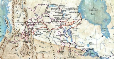
The North West Company map prepared by David Thompson covered an area of two million three hundred and forty thousand square miles from Lake Superior and Hudson Bay to the mouth of the Columbia River.
The David Thompson map was placed in the Great Hall of the North West Company headquarters at Fort William which was located on Thunder Bay of Lake Superior. In 1814, he revised all of his surveys into a second great map that measured six and a half by ten feet long. The revised David Thompson map showed an accurate location of all the North West Company posts.
Below is a map showing the explorations of David Thompson during his life. This map was published by the National Geographic Society May, 1996
Click on the thumbnail for a full image.
