Subject Guide

Mountain West
Malachite’s Big Hole
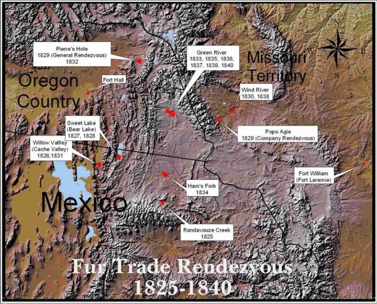
Map of Fur trade Rendezvous 1825-1840:
This map below shows the locations of fur trade rendezvous from 1825-1840, with the geopolitical boundaries which existed at that time. Oregon Country was under joint administration by both Great Britain and the United States. One of the major goals of the Hudson’s Bay Company, a quasi-governmental monopoly, during this period was the creation of a fur desert in the Rocky Mountain region. It was believed that without the economic incentives of the fur trade, that the Americans would abandon the Oregon Country, and it would then pass into British control.
The northern border of Mexico during this time coincided with what are now the northern boundaries of the states of California, Nevada, and a portion of Utah. As can be seen from the map, six of the rendezvous were held in the territory of Mexico. It is doubtful that either the Americans or Mexicans knew that these gatherings were being held on the territory of Mexico. This area was far from any of the population centers of Mexico and was important to Mexico primarily as a buffer zone separating it’s population from potential enemies, either the British or Americans.
Click on the Map below for a full sized image.